Yosemite National Park Lodging and Activities California United States - A tranquil river flows through rocky terrain, blending water and stone
mountain

Mapping Your Way to Yosemite

Getting to Yosemite is easier than you think! Fly into Sacramento, San Francisco or Fresno, then drive just a few hours to reach the park. Roads are open year-round, except for Tioga Road in winter. Check road conditions before traveling to ensure a smooth journey to this incredible destination.

NOTE: Road and infrastructure repairs are underway in Yosemite and can cause delays. Call the National Park Service information line at 209.372.0200 or visit the National Park Service road conditions page for the latest updates.

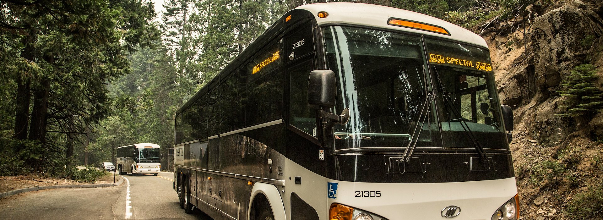
Yosemite Area Regional Transportation System (YARTS) provides bus service to Yosemite. For information, call 877.989.2787.

Greyhound doesn't offer direct bus service to Yosemite, but can be combined with YARTS service from Merced, CA. 800.229.9424 or 800.531.5332 (en Español) Traffic and parking can be challenging in the summer months in Yosemite Valley, so consider utilizing YARTS and sit back and enjoy the views. Ride & Save: YARTS passengers can now enjoy a 15% discount at Degnan's Kitchen in Yosemite Village. See flyer. Yosemite Valley to Tuolumne Meadows Hikers Bus Visitors can use the Tuolumne Meadows Hikers bus to reach Tuolumne Meadows on select days during the summer season.

Ride & Save: YARTS passengers can now enjoy a 15% discount at Degnan's Kitchen in Yosemite Village. See flyer.

Yosemite Valley to Tuolumne Meadows Hikers Bus

Visitors can use the Tuolumne Meadows Hikers bus to reach Tuolumne Meadows on select days during the summer season.

Nearby commercially served airports include:

  • Fresno/Yosemite International Airport (FAT) - 1.25 hours to Southern entrance via Highway CA-41. 2.5 hours to the heart of Yosemite Valley. 3½ hours to Tuolumne Meadows. Public transportation from Fresno to Yosemite is available via the Yosemite Area Regional Transit System (YARTS).
  • San Francisco International Airport (SFO) - 2 ½ hours to Big Oak Flat entrance via Highway CA 120, 3 ½ hours to heart of Yosemite Valley. 4-5 hours to Tuolumne Meadows. Public transportation available to Yosemite.
  • Los Angeles International Airport (LAX) - 6 hours to Yosemite Valley via I-5 to Highway CA 99 to Highway CA 41. Add another 1.5 hours for travel to Tuolumne Meadows.
  • Oakland (OAK) - 2.75 hours to Big Oak Flat entrance via Highway CA 120, 3 ½ hours to heart of Yosemite Valley. 4-5 hours to Tuolumne Meadows. Public transportation available to Yosemite.
  • Sacramento (SMF) - 2 ¼ hours to Big Oak Flat entrance via Highway CA 120, 3.5 hours to heart of Yosemite Valley, and 4 hours to Tuolumne Meadows. Public transportation available to Yosemite.
  • Mammoth Lakes, Las Vegas and Reno airports provide access to Yosemite from the Eastern Sierra when Tioga Road Highway CA 120 is open during the summer and fall. Tioga Road closes for the winter depending on the weather conditions. Check the National Park Service Road Conditions for more information.
  • Mammoth Yosemite Airport (MMH) - 2½ hours to Yosemite Valley via Highway CA 395 and Highway CA 120 Tioga Rd. 1 ¼ hours to Tuolumne Meadows. (June - Oct). Call ahead for road opening.
  • Reno International Airport (RNO) - 4 hours to Yosemite Valley via Highway CA 395 and Highway CA 120 Tioga Rd. (June - Oct) Call ahead for road opening.
  • Las Vegas Airport (LAS) - 8-9 hours to Yosemite Valley via Highway CA 395 and Highway CA 120 Tioga Rd. (June - Oct). Call ahead for road opening.

Nearby municipal airports for private and charter service include:

Mariposa-Yosemite Airport (068) - 30 minutes to Arch Rock entrance station via Highway Ca140, 1 hour to the heart of Yosemite Valley. The paved runway extends for 3,310 feet. The facility is at an elevation of 2,250 feet at a distance of about 4 miles from Mariposa, CA. http://www.airnav.com/airport/O68

Merced Municipal Airport/Macready Field (MCE) - 1 ¼ hours to Arch Rock entrance station via Highway CA 140, 1 ¾ hours to heart of Yosemite Valley. The paved runway extends for 5,903 feet. The facility is at an elevation of 156 feet at a distance of about 2 miles from Merced, CA. http://www.airnav.com/airport/MCE

AMTRAK® Trains serve San Diego, Los Angeles, Fresno, San Jose, San Francisco and Sacramento to and from Merced/Riverbank and connect with YARTS bus lines for direct buses into Yosemite Valley. For information call 800.872.7245 or visit http://www.amtrak.com/
Cars are welcomed in Yosemite National Park, and visitors pay an entrance fee of $35. There is free parking in Yosemite, but it is limited. So, arrive early if you want one of these parking spots. Once you're at the park, we recommend that you leave the driving to us, with our efficient shuttle bus system that'll get you everywhere you need to go. You can find out more on the public transportation page.

Coming From

  • From San Francisco

    Via Highway CA 120

    • Take the Oakland-Bay Bridge (Highway 80 East)
    • Take Highway 580 east, following signs for Tracy/Stockton to Highway 205
    • Follow Highway 205 to Highway 120
    • Take Highway 120 into Yosemite National Park

    Via Highway CA 140 East

    • Take the Oakland-Bay Bridge (Highway 80 East)
    • Take Highway 580 east, following signs for Tracy/Stockton to Highway 205
    • Turn onto Hwy 99 South
    • Take CA 140 East through Mariposa into Yosemite.
  • From Sacramento

    Via Highway CA 120

    • Take Highway 99 South to Manteca
    • Exit onto Highway 120 East in Manteca and follow directly into Yosemite

    Via Highway CA 140 East

    • Take Highway 99 South to Merced.
    • Exit onto Highway 140 East in Merced and follow directly into Yosemite.

    Lowest elevation route, during heavy snowstorms, this route may be a better alternative to Highway 120.

  • From Los Angeles

    South Entrance Via Highway CA 41

    • Follow Interstate 5 North toward Bakersfield.
    • Just beyond the Grapevine towards Bakersfield, follow Highway 99 North to Fresno.
    • From Fresno, follow Highway 41 to Yosemite Valley.

    Alternate Winter Directions Via Highway CA 140

    • Follow Interstate 5 North toward Bakersfield.
    • Just beyond the Grapevine, follow Highway 99 North to Merced.
    • From Merced follow Highway 140 East to Yosemite Valley.
  • From Central Valley

    South Entrance Via Highway CA 41

    • Follow Interstate 5 North toward Bakersfield.
    • Just beyond the Grapevine towards Bakersfield, follow Highway 99 North to Fresno.
    • From Fresno, follow Highway 41 to Yosemite Valley.

    Alternate Winter Directions Via Highway CA 140

    • Follow Interstate 5 North toward Bakersfield.
    • Just beyond the Grapevine, follow Highway 99 North to Merced.
    • From Merced follow Highway 140 East to Yosemite Valley.

    Northern - Via Highway CA 140

    • Take Highway 99 to Merced
    • From Merced, follow Highway 140 East to Yosemite Valley.

    Southern - Via Highway CA 41

    • Take Highway 99 to Fresno.
    • From Fresno, follow Highway 41 to Yosemite Valley
  • From the Monterey Peninsula

    Via Highway CA 140

    • Take Route 1 to Highway 156 E / Route 101 N to Highway 152 N (also known as Pacheco Pass Highway).
    • Follow signs for Highway 99 N towards Merced.
    • Exit Highway 99 onto Highway 140 E at Merced and follow Highway 140 to Yosemite.
  • From South Lake Tahoe/Reno

    Summer Via Highway CA 120 Late May/June - October/November

    • From South Lake Tahoe, take Highway 89 South to Highway 395 South.
    • At Tioga Road (Highway 120), make a right, and head up Tioga Pass.
    • Stay on Highway 120 West towards Yosemite Valley and follow the signs to Yosemite Village.
      Reno - Follow above directions as of Highway 395 South.

    Winter Via Highway CA 120 October/November - Late May/June

    • From South Lake Tahoe, take Highway 89 South to Highway 50 West.
    • Head West on Highway 50 until you reach Highway 99, and then head South.
    • At Highway 120 head East to Yosemite National Park.
    • Follow Highway 120 into Yosemite Valley and follow signs to Yosemite Village.

    Reno - Via Highway Highway 120 East

    • Follow directions of your choice to Highway 80 to Sacramento and Route 99.
    • Head South to Route 99 South to Route 120 East.
    • Follow Route 120 East into the Park.
  • From Las Vegas

    Summer and Fall Via Highway CA 120 (Eastern Sierra)

    • Take I-95 North to 266 West - approximately 170 miles
    • Travel 266 West to 168 West - approximately 44 miles
    • Travel 168 West to I-395 North - approximately 38 miles
    • Follow Highway US 395 to Lee Vining (80 miles) where you will exit Highway 395 and continue on Highway 120 into Yosemite National Park. (Portions of Highway 120 may be closed seasonally).

    Winter and Spring Via Highway CA 41 (Western Sierra)

    • Take I-15 S toward Bakerfield/Los Angeles for 160 +/- miles.
    • Merge onto CA-58 W toward Bakerfield and stay on for 125 miles.
    • Merge onto Highway 99 N toward Fresno/Sacramento and follow for 110 +/- miles.
    • Merge onto Highway 41 N toward Yosemite.
    • Take CA-41 for 60 miles, traveling through Oakhurst and Fish Camp, to Yosemite's south entrance near Wawona Hotel.
colored shape